 Washington
Washington
Washington
This quiet oasis of wetlands and shady campgrounds in the arid Yakima Valley sits at what was once the northernmost shoreline of a temporary inland sea. During the Missoula Floods, the bottleneck at Wallula Gap backed water up across the...
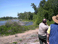
This quiet oasis of wetlands and shady campgrounds in the arid Yakima Valley sits at what was once the northernmost shoreline of a temporary inland sea. During the Missoula Floods, the bottleneck at Wallula Gap backed water up across the entire Columbia Basin, creating Glacial Lake Lewis -- and this park marks where its waves lapped against the Yakima Valley's northern edge, roughly 1,250 feet above modern sea level. The lake's fine-grained sediments settled here, creating the fertile soils that now support the park's 140 bird species, including wood ducks, red-winged blackbirds, herons, and hawks. The park's wetlands, marshes, and juvenile fishing pond all owe their existence to the clay-rich flood deposits that hold water in this otherwise desert landscape. At 266 acres, Yakima Sportsman was originally created by the Yakima Sportsman's Association to promote game management, and its irrigated green zone stands in stark contrast to the sagebrush desert surrounding it. Stand in the park and look south: everything between here and Wallula Gap, 100 miles away, was once beneath hundreds of feet of backed-up floodwater.
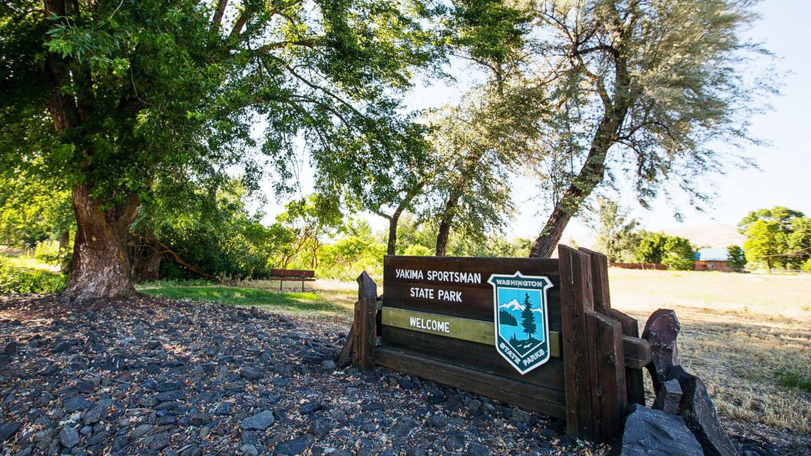
Open seasonally, closed November 1 through March 1. During the operating season, hours are 8 a.m. to dusk. Discover Pass required for day use; camping fee includes parking. 37 standard sites and 37 full-hookup sites; one tent-only group camp (up to 100). Located on the Yakima River floodplain on the east side of Yakima, Washington. Note: Levy Trail is under ecosystem-restoration construction through late 2027.
Yakima sits in the Yakima Fold Belt, folded Columbia River Basalt ridges (Yakima Ridge to the north, Rattlesnake Hills to the south) cut by the Yakima River as the folds rose. Relevant to the Missoula floods, the Yakima Valley was a backwater of Lake Lewis. Floods that backed up behind Wallula Gap to ~900 ft over the modern Tri-Cities also surged west up the lower Yakima Valley, dropping fine slackwater silt and sand that built the agriculturally productive soils that now support the valley's orchards and vineyards. The state park itself sits on this flood-derived valley fill rather than on flood-eroded bedrock, the park's interpretive value for the floods is therefore as an accessible example of a slackwater depositional setting rather than as a flood-erosion site. The valley was not a primary floodway; flood velocity here was low, depth varied with the height of Lake Lewis between successive pulses.
No site-specific publications since the Balbas et al. (2017) Lake Lewis anchor date (18.2 ka peak flood).
The park is one of the dozen-plus Washington state parks listed as Ice Age Floods National Geologic Trail features; the IAFI Lake Lewis Chapter covers the Yakima Valley in its publications. There is no permanent IAFI panel or chapter office at the park.
Best April through October (the park is closed in winter anyway). Camping is the primary draw; the geology is subtle and best appreciated in context with a visit to Wallula Gap and the White Bluffs to understand what Lake Lewis looked like during peak flood.
Ice Age Floods National Geologic Trail
Yakima Sportsman State Park is, literally, an oasis in the desert.
Located near the urban amenities of Yakima in arid eastern Washington, this park attracts local picnickers, out-of-town visitors and road-trippers passing through.
Birds flock to Yakima Sportsman, and so do birders, their binoculars and field guides in hand. The Yakima River flood plain sustains a natural wetland of marshes, grasses and ponds, welcoming habitat for 140 bird species. Wood ducks are the stars of the show, but dramatic red-winged blackbirds, herons and hawks make their home near the park’s juvenile fishing pond, which is stocked with rainbow trout and open to young anglers.
The gentle trails come alive in season. The trees turn red, orange and yellow in fall, and spring brings a riot of lilies, chokecherry, dogwood and blossoming catalpa trees. Green lawns and tree shade make this a lovely camping or picnic spot in summer.
Yakima Sportsman State Park is a 266-acre camping park originally created by the Yakima Sportsman’s Association to promote game management and the preservation of natural resources. The park is an irrigated green zone in an otherwise desert area and has a variety of deciduous trees in the camping and picnic areas.
More than 130 species of bird make wildlife watching a delight. The campground is a stay-over place for events at the Yakima Sun-Dome and fairgrounds.
Discover Pass: A Discover Pass is required for vehicle access to state parks for day use. For more information about the Discover Pass and exemptions, please visit theDiscover Pass web page.
A Discover Pass is required for vehicle access to state parks for day use. For more information about the Discover Pass and exemptions, please visit theDiscover Passweb page.
Visit us atFacebook,Mastodonand ourYouTube Channel.
Ice Age Floods Institute is a 501(c)(3) tax-exempt non-profit EIN 91-1658221Donations and member fees may be tax deductible
Flood-extent overlay shows the maximum reach of the Missoula Floods.
The site in its place along the flood path, with the maximum flood extent drawn over the modern map.
View on the interactive map Searchable sites · 360° trails · flood reconstruction