 Washington
Washington
Washington
The REACH Museum in Richland, Washington, sits on land that would have been beneath hundreds of feet of floodwater during the Missoula Floods, submerged by Glacial Lake Lewis when the Wallula Gap bottleneck backed water across the entire...
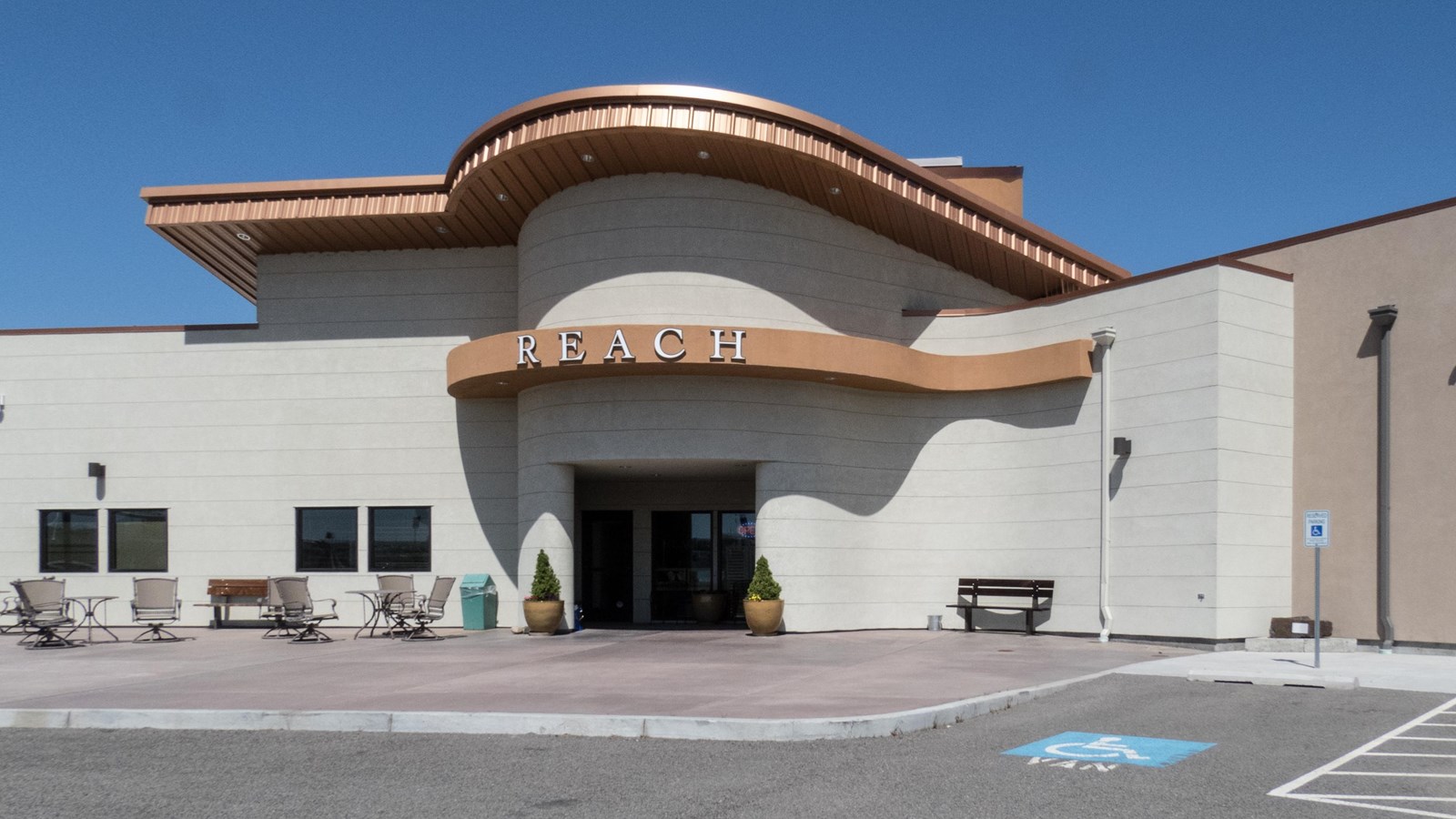
The REACH Museum in Richland, Washington, sits on land that would have been beneath hundreds of feet of floodwater during the Missoula Floods, submerged by Glacial Lake Lewis when the Wallula Gap bottleneck backed water across the entire Pasco Basin. The museum shares the natural and human history of the Tri-Cities area, including exhibits on the Manhattan Project, Indigenous peoples, and the cataclysmic ice age floods. Across the river, the White Bluffs -- towering 50 to 170 meters high -- expose the Ringold Formation, ancient river sediments laid down 8.5 to 3.4 million years ago, capped by younger rhythmite deposits from the floods themselves. The Hanford Reach, the longest free-flowing nontidal section of the Columbia River at 51 miles, owes its preservation to the Manhattan Project's security buffer, which inadvertently protected the shrub-steppe ecosystem. The museum's outdoor learning area features hands-on exhibits about the local landscape, and visitors can see how flood deposits, nuclear history, and native ecology are woven into the same terrain. Stand on the museum grounds and consider that the water above you during a flood event would have reached higher than a 40-story building.
The REACH Museum is at 1943 Columbia Park Trail in Richland, Washington, on the banks of the Columbia near the gateway to the Hanford Reach National Monument. Open Tuesday–Saturday with seasonal variation; check current hours and admission rates before visiting. Indoor galleries, an outdoor learning area, and rotating exhibits. Admission charged; member discounts apply.
Gallery I focuses explicitly on the Ice Age floods and their role in shaping the Hanford Reach landscape and the broader Pasco Basin. This is one of the strongest Ice Age Floods interpretive experiences in southeastern Washington. The Pasco Basin lay at the receiving end of every Missoula flood, backflooded slackwater here built up behind Wallula Gap to elevations of approximately 1,250 feet, drowning the basin and depositing rhythmically bedded Touchet Beds in side valleys (most famously in the Walla Walla Valley). Each flood backed up for days to weeks before draining through Wallula. The REACH connects this story to the Columbia River's ongoing role, indigenous occupation, Manhattan Project history, and the establishment of the Hanford Reach National Monument.
Local flood-deposit work continues at the Coyote Canyon Mammoth Site (Last et al. 2021, MDPI Quaternary), which dates Missoula Flood deposits and overlying tephra adjacent to a Columbian mammoth bone bed near Kennewick. The REACH has hosted related programming.
The Lake Lewis Chapter (Tri-Cities) treats The REACH as its primary public partner and has provided exhibit input. IAFI testimony to Congress in support of the National Geologic Trail (Kleinknecht, 2006) explicitly highlighted The REACH as a future trail anchor.
Year-round visit; allow 1.5–2 hours for the galleries plus optional outdoor area. Strong starting or ending point for a Tri-Cities and Walla Walla Valley flood-geology loop including Wallula Gap and the Touchet Beds at Burlingame Canyon.
Ice Age Floods National Geologic Trail–Lewis and Clark National Historic Trail
At The REACH Museum in Richland, Washington, you can learn about the natural and human history of the Tri-Cities. It houses rotating and permanent exhibits, including a robust exhibit on the Manhattan Project and Cold War. The REACH museum’s outdoor learning area features a sampling of the shrub steppe and riparian ecosystems and provides hands-on activities that are fun while teaching important themes like irrigated agriculture, hops cultivation, local animals, native plants, and land formation.
The REACH Museum shares the natural and human history of the Tri-Cities and the surrounding area. The museum takes its name from Hanford Reach, the longest free flowing (undammed), non-tidal section of the Columbia River. The 51mile (82 kilometer) Reach marks the northern and eastern boundary of today’s Hanford Site. Its waters were critical to the site’s plutonium production mission during the Manhattan Project and Cold War.
The Hanford Reach’s wild and untamed nature is a direct legacy of the Manhattan Project and the Cold War. Manhattan Project officials removed pre-war agricultural operations and prohibited further development. This formed a large security buffer surrounding the project and inadvertently preserved the shrub steppe ecosystem. When plutonium production stopped, the reduced size of the Hanford Site opened the opportunity for creation of theHanford Reach National Monument, the US Fish and Wildlife Service’s first national monument.
The REACH Museum features rotating and permanent exhibits, including robust presentations on the Manhattan Project, Cold War, indigenous peoples, and cataclysmic ice age floods. An outdoor learning area displays a sampling of the shrub steppe and riparian ecosystems and provides hands-on, interactive activities that are fun while teaching important themes including irrigated agriculture, hops cultivation, local animals, native plants, and land form

Flood-extent overlay shows the maximum reach of the Missoula Floods.
The site in its place along the flood path, with the maximum flood extent drawn over the modern map.
View on the interactive map Searchable sites · 360° trails · flood reconstruction