 Washington
Washington
Washington
The McBones dig site near Kennewick, Washington, is where the Ice Age Floods meet the Ice Age megafauna in a single excavation trench. Volunteers and researchers work each season to unearth the remains of Columbian mammoths -- massive...
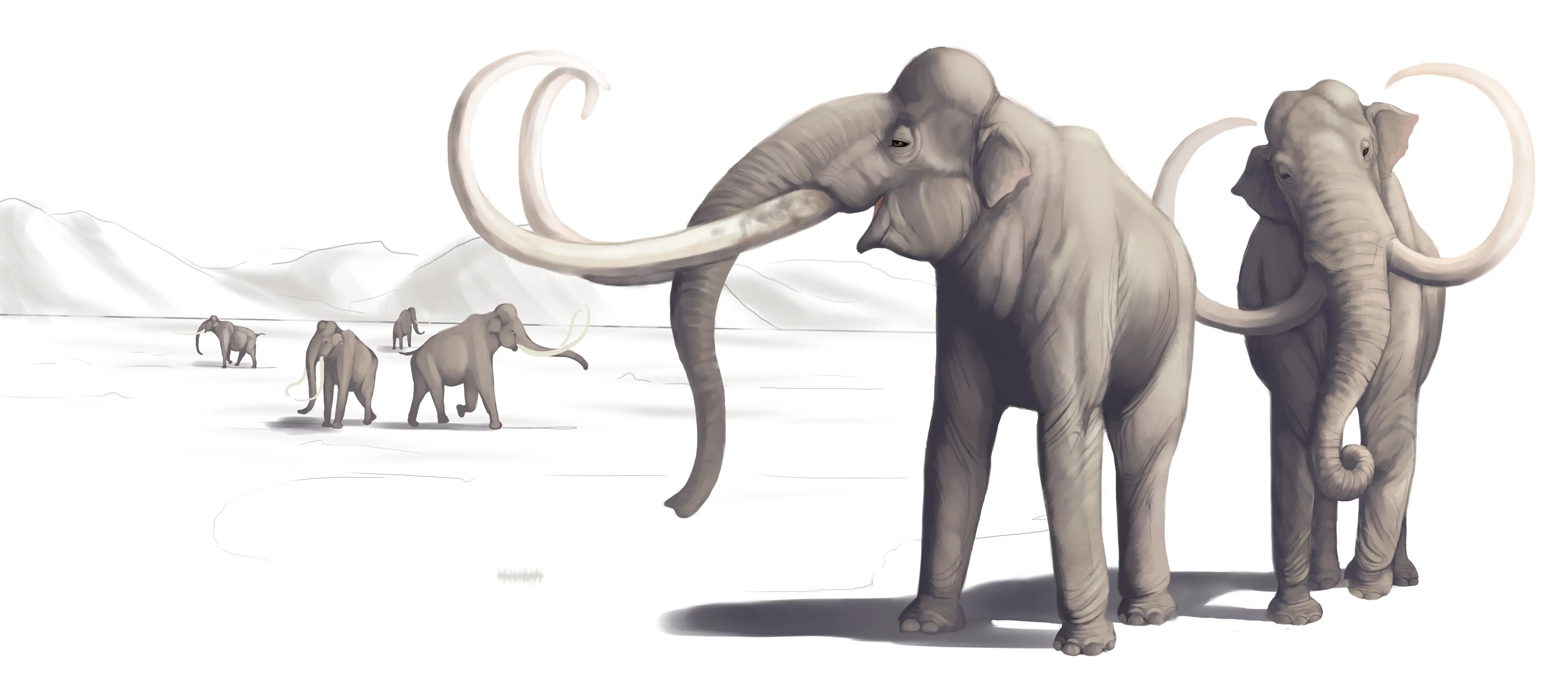
The McBones dig site near Kennewick, Washington, is where the Ice Age Floods meet the Ice Age megafauna in a single excavation trench. Volunteers and researchers work each season to unearth the remains of Columbian mammoths -- massive beasts that stood 13 feet tall and weighed up to 10 tons -- buried in the flood-deposited sediments of the Horse Heaven Hills. The dig, organized by the Lake Lewis Chapter of the Ice Age Floods Institute, has recovered bones, tusks, and teeth that tell the story of animals living in a landscape repeatedly devastated by megafloods. The sediment layers at the site preserve a record of alternating catastrophe and recovery: flood rhythmites interspersed with soil horizons and animal remains from the intervals between floods. The project demonstrates that the Missoula Floods story is not just about water and rocks but about the living world that endured -- and sometimes did not survive -- the most violent geological events in North American history. Visitors during dig season can watch paleontology in action.
Tours only, site not open to the public for drop-in visits. Located in Coyote Canyon in the Horse Heaven Hills, southwest of Kennewick, Washington. Public tours run April through October on selected dates (9 a.m. and 11 a.m., usually 1–2 weekends per month); ~2 hours; $10 per person; capacity 30 per tour. Reservations open online at mcbones.org each January; tours typically sell out. Contact Gary Kleinknecht, 509-438-9417.
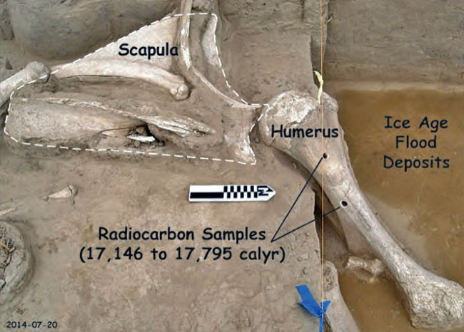
McBones is the field site of the MCBONES Research Center's excavation of a Columbian mammoth (Mammuthus columbi) buried in Missoula Flood slack-water sediments roughly 17,000 years ago. The animal, likely killed and entombed by an earlier Missoula Flood pulse, lies in fine-grained rhythmites (Touchet Bed equivalents) on the west side of Coyote Canyon, buried under roughly six successive flood-sediment layers. The site is one of the very few documented examples on the trail where a megafaunal carcass and Missoula Flood stratigraphy are directly co-located, allowing flood timing, animal age at death, and post-mortem transport to be studied together. The mammoth is consistent with the early-phase Missoula floods bracketed by Balbas et al. (2017) at the ~18.2 ka end of the flood window. Active excavation continues each season.
The site has appeared in regional press coverage 2023–2026 with updates on additional bones recovered and on K–12 educational programming. No major peer-reviewed paper has yet been published on the Coyote Canyon mammoth specifically; recovery and analysis are ongoing.
The Lake Lewis Chapter (Tri-Cities) is closely aligned with MCBONES and frequently co-hosts events. IAFI maintains a feature page. MCBONES is an independent 501(c)(3) but operates effectively in partnership with the Ice Age Floods Trail.
Tours April–October only. Wear sturdy shoes and hat; the dig site is exposed and the road in is rough. Combine with the REACH Museum in Richland, which has a Coyote Canyon Mammoth exhibit available year-round when tours are not running.

Flood-extent overlay shows the maximum reach of the Missoula Floods.
The site in its place along the flood path, with the maximum flood extent drawn over the modern map.
View on the interactive map Searchable sites · 360° trails · flood reconstruction