 Washington
Washington
Washington
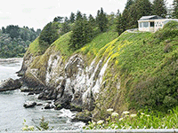
Perched on a cliff 200 feet above the pounding Pacific surf at Cape Disappointment, the Lewis and Clark Interpretive Center marks where the Ice Age Floods met the ocean -- the end of a 500-mile journey from the ice dam in Montana to the...
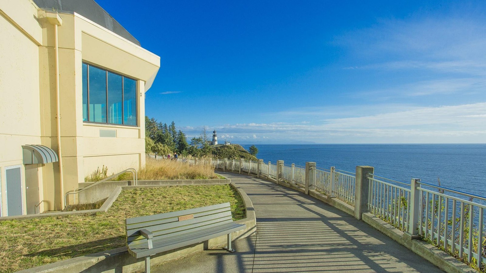
Perched on a cliff 200 feet above the pounding Pacific surf at Cape Disappointment, the Lewis and Clark Interpretive Center marks where the Ice Age Floods met the ocean -- the end of a 500-mile journey from the ice dam in Montana to the sea. During the Missoula Floods, the coastline was more than 25 miles farther west than it is today, meaning the floodwaters had even farther to travel before finally dissipating into the Pacific. The volume of sediment carried by the floods reshaped the continental shelf offshore, depositing massive fans of gravel and sand that geologists have mapped on the ocean floor. The center itself tells the story of the Lewis and Clark expedition's Pacific Coast stay during the winter of 1805-1806, with mural-size timeline panels and interactive exhibits. But the geological story runs deeper: English fur trader John Meares named this headland 'Cape Disappointment' in 1788 when he failed to find the Columbia River's mouth -- a river mouth shaped by floods he could not have imagined. The Cape Disappointment Lighthouse nearby is the oldest operating lighthouse on the West Coast, standing guard over the 'Graveyard of the Pacific' where the Columbia's flood-sculpted channel meets the sea.
This refers to the Lewis & Clark Interpretive Center at Cape Disappointment State Park (Ilwaco, Washington), not the Great Falls (MT) or Sacajawea (Pasco, WA) facilities. Open Wednesday–Sunday 10 a.m.–5 p.m. (summer extends to 7 days/week). Admission: $5 adults, $2.50 ages 7–17, free under 6, plus Discover Pass for park entry. Located on a 200-foot bluff above the Columbia River bar.
Cape Disappointment marks the terminus of the Missoula Flood path, the bar at the Columbia's mouth is where flood-transported sediment finally entered the Pacific. The Missoula Floods carried an estimated 50 cubic miles of eroded basalt, loess, and ice-rafted erratics from eastern Washington and the Columbia Gorge west; much of that load deposited as the Astoria Submarine Fan, a 200-mile-long deep-sea fan offshore. The cape itself is older (Eocene/Miocene marine sediments capped by Columbia River Basalt headlands), but the modern Columbia River bar and the Long Beach Peninsula immediately north were built up by post-flood sediment redistribution. The interpretive center's primary exhibits are Lewis & Clark expedition history, Chinook tribal history, and maritime history; flood interpretation is supplemental signage rather than a main exhibit theme.
No site-specific updates since Brunner et al. (1999) on the Astoria Fan offshore record. Wiedmann et al. (2021) ocean-coring work continues to refine the offshore flood-sediment chronology consistent with Balbas et al. (2017).
Cape Disappointment State Park is listed on the IAFI feature page as the western trail terminus. The Lower Columbia Chapter occasionally includes the cape on field trips. No dedicated IAFI exhibit at the interpretive center.
Best May through October for visibility; winter brings legendary storms (the cape averages 110 inches of rain). The North Head Lighthouse and the McKenzie Head trail extend the visit. The view east up the Columbia is the only place on the trail where you can see "where it all ended up."
Ice Age Floods National Geologic Trail,Lewis & Clark National Historic Trail
English fur trader John Meares was mistaken as he stood on the northern shore of the mouth of the Columbia River in July 1788. He was in search of the great river, but what appeared before him seemed to be a large bay, so he named the high bluff above the Columbia’s mouth, “Cape Disappointment.”
When you visit Cape Disappointment State Park today, you certainly won’t be disappointed in what you find. It’s an amazing park that’s home to the Lewis and Clark Interpretive Center.
Perched on a cliff 200 feet above the pounding Pacific surf, the Lewis and Clark Interpretive Center shares the story of the Corps of Discovery’s journey, focusing particularly on their Pacific Coast stay during the winter of 1805-1806. A series of mural-size timeline panels guide visitors through the westward journey of the Expedition using sketches, paintings, photographs, and the words of the journal writers.
It’s a wonderful stop for families with numerous interactive exhibits. Children can try to pack a canoe without tipping it, follow a treasure hunt, and check out what the Corps ate on their journey. The center features a short film presentation, a nicely outfitted gift shop, and a glassed-in observation deck with fabulous views of the river, headlands, and ocean. Additional displays focus on local maritime and military history.
During winter and spring, trained volunteers come to the center to help visitors spot migrating Gray Whales. You can also learn about the nearby North Head and Cape Disappointment Lighthouses. The lighthouses both function to protect mariners from the rough and ever-changing Columbia River Bar in the treacherous area known as the “Graveyard of the Pacific.” The Cape Disappointment Lighthouse is the oldest operating lighthouse on the West Coast.
Cape Disappointment was armed with smoothbore cannons to protect the mouth of the Columbia during the Civil War. In 1875, the area w
Flood-extent overlay shows the maximum reach of the Missoula Floods.
The site in its place along the flood path, with the maximum flood extent drawn over the modern map.
View on the interactive map Searchable sites · 360° trails · flood reconstruction