 Washington
Washington
Washington
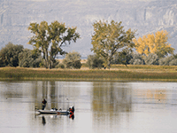
Fifty miles long, up to 900 feet deep, and as much as five miles wide, the Grand Coulee is the largest coulee on Earth -- a canyon so vast it defied explanation until geologists understood the incredible scale of the Missoula Floods. When...
Fifty miles long, up to 900 feet deep, and as much as five miles wide, the Grand Coulee is the largest coulee on Earth -- a canyon so vast it defied explanation until geologists understood the incredible scale of the Missoula Floods. When the Okanogan Lobe of the Cordilleran Ice Sheet blocked the Columbia River, floodwaters from Glacial Lake Missoula were forced to find a new path across the Columbia Plateau. The diverted water carved the Grand Coulee through layer after layer of Columbia River basalt in a matter of days during each flood event, stripping away millions of years of volcanic rock with a force that created the largest waterfall the world has ever known at Dry Falls. The coulee is divided into the Upper and Lower sections by Dry Falls, and its floor is now dotted with lakes including Banks Lake, a reservoir that fills much of the Upper Coulee. Dr. Gene Kiver, who spent decades studying the Grand Coulee, called it a 'must-see feature' whose immense scale makes the forces that created it apparent to anyone who reads the evidence in its rocks. Drive the full 50 miles and you will witness one of the most dramatic canyons carved anywhere on Earth.
The Grand Coulee is the 50-mile north-south canyon between Banks Lake (upper) and Soap Lake/Ephrata (lower), in central Washington. Multiple access points: the Dry Falls overlook (Sun Lakes-Dry Falls State Park) is the marquee stop, with Grand Coulee Dam and its Visitor Center at the north end and Lake Lenore Caves, Steamboat Rock State Park, and Banks Lake all in between. Discover Pass required for state-park parking; the Grand Coulee Dam Visitor Center is free. Important for 2026: the Dry Falls Visitor Center is closed for the full year for major renovation; FloodFest is being relocated.
The Grand Coulee is the largest single feature in the channeled scabland system. It was carved by 40–60+ Missoula flood events as floodwaters, blocked from their original western-Columbia route by the Okanogan lobe (after about 15.6 ka per Balbas et al. 2017), poured south across the Columbia Plateau, spilled over the Coulee Monocline at present-day Dry Falls, and excavated headward to the Columbia at Grand Coulee Dam. Dry Falls at peak was a 5-mile-wide, 400-ft-tall cataract carrying roughly ten times the discharge of all modern rivers combined. The upper coulee scoured to bedrock; the lower coulee preserves a series of cataract-recession plunge basins, including the Dry Falls–Monument–Deep Lake cluster.
The Balbas et al. 2017 cosmogenic chronology made the most significant recent update: it established that the Upper Grand Coulee did not fully open as the dominant flood route until after 15.6 ± 1.3 ka, after the Okanogan lobe blocked the western Columbia route. The last Missoula floods through the coulee occurred at 14.7 ± 1.2 ka. No major updates found since 2017.
The Lower Grand Coulee chapter is the primary IAFI presence; the chapter coordinates FloodFest, ordinarily based at Dry Falls. Chapter field trips and presentations occur multiple times per year.
Year-round, though the Dry Falls Visitor Center is closed through 2026. Stops worth combining: Dry Falls overlook, Steamboat Rock, Lake Lenore Caves, Sun Lakes potholes/Deep Lake, Grand Coulee Dam Visitor Center, and Banks Lake. Allow at least one full day; two days does it justice.
The 50-mile-long Grand Coulee should be on everyone’s bucket list for a “must see” feature. The immense power of the forces that created the Coulee are apparent to those who read the evidence recorded in its rocks and landforms. How did the Coulee form? Why did it form here? What do features like Steamboat Rock, Northrup Canyon, Dry Falls, and theEphrata Fan tell us about the geological forces that created the Grand Coulee?
This presentation will be made May 1, 2023 beginning at 7:00 pm, via Zoom _https://us02web.zoom.us/j/82985244730
Dr Gene Kiver is professor Emeritus of Geology, Eastern Washington University. He studied alpine glaciation in the Rocky Mountains before moving to Washington State and discovering that J Harlen Bretz had correctly interpreted the bizarre landforms of the Channeled Scabland. Gene taught geology at Eastern Washington University for 34 years. He co-authored “On the Trail of Ice Age Floods” with Bruce Bjornstad that describes the flood history of the northern flood routes of the Missoula Floods. In addition, he authored/co-authored the book “Washington Rocks” and several other books. One item in particular is “Tour Guide Interstate 90 East Tour: Seattle to Spokane” (2007). A CD narration of the people and places as defined by the title. Of the 51 tracks, Dr. Kiver narrates 4 on the Geology of I-90. The Chapter webmaster has ordered it and will update this post after listening to the recording. I bring this up as many of our lectures are about or by people who explored or are exploring the geography of the Ice Age Floods. Look on Amazon under “Eugene Kiver” for this and other books.


Flood-extent overlay shows the maximum reach of the Missoula Floods.
The site in its place along the flood path, with the maximum flood extent drawn over the modern map.
View on the interactive map Searchable sites · 360° trails · flood reconstruction