 Idaho
Idaho
Idaho
Idaho
Farragut State Park marks ground zero for the Missoula Floods -- the exact spot where the ice dam in the Clark Fork valley failed and a churning slurry of water, ice, boulders, and debris erupted from the south end of Lake Pend Oreille....
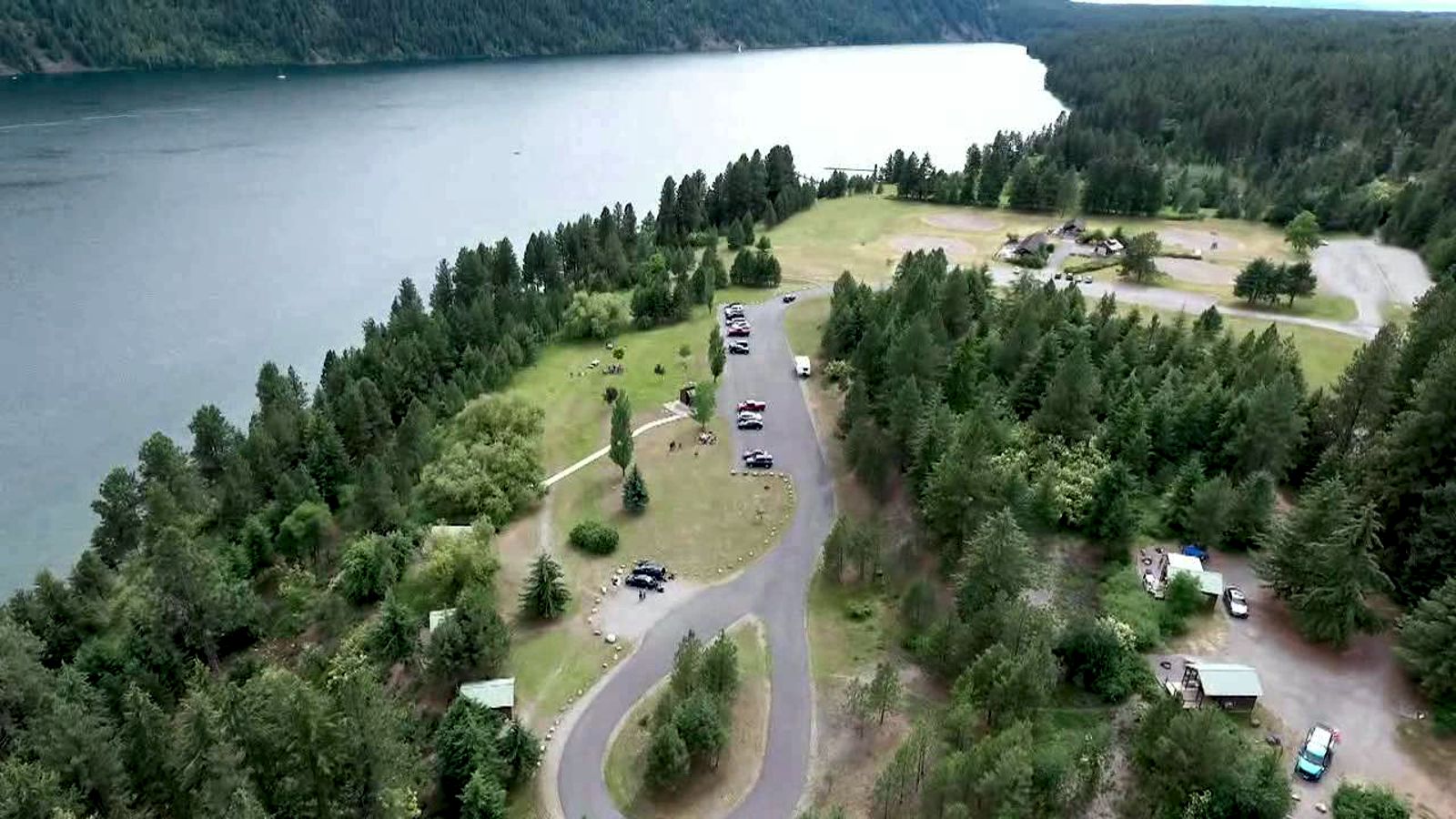
Farragut State Park marks ground zero for the Missoula Floods -- the exact spot where the ice dam in the Clark Fork valley failed and a churning slurry of water, ice, boulders, and debris erupted from the south end of Lake Pend Oreille. Nearly all of the water escaping from Glacial Lake Missoula passed through this area, with discharge estimates ranging from 14 to 21 million cubic meters per second -- a flow rate that qualifies as perhaps the worst megaflood in Pleistocene history worldwide. The park sits at the southern tip of Lake Pend Oreille, where the 20-mile-long tongue of ice occupying the lake basin fractured and broke apart, releasing floodwaters 2,000 feet deep that surged across what is now the park. Hoodoo Channel, an abandoned outlet of the lake visible in the park, was carved by late-glacial meltwater and final outbursts from Glacial Lake Missoula, and its closed depressions were likely formed by stranded icebergs melting in place. The park's rolling terrain of kettles and glacial deposits sits atop the Rathdrum Prairie Outburst Plain, a vast spread of flood debris. Walk the trails at Farragut and you are walking where the largest floods on the continent began their 500-mile journey to the Pacific.
Farragut State Park is on the south shore of Lake Pend Oreille at Bayview, Idaho, on the site of the former WWII Farragut Naval Training Station. Open year-round; Idaho State Park motor vehicle entry fee applies ($7/day non-resident, $5/day resident in current schedules). Full visitor facilities, museum, and miles of trail.
Farragut sits directly at the breakout point for Glacial Lake Missoula. The Purcell Trench lobe of the Cordilleran Ice Sheet, advancing south from British Columbia, terminated against Green Monarch Ridge on the east side of the present Lake Pend Oreille basin, the ice dam that impounded Glacial Lake Missoula was anchored here. When the ice dam failed, floodwaters surged south and west through the Pend Oreille basin and out via the Rathdrum Prairie. The park preserves Hoodoo Channel, an abandoned ice-marginal outlet of Lake Pend Oreille pock-marked with kettle-like depressions interpreted as melt-out features from stranded icebergs. Other landforms include outwash terraces, kame deposits, and scoured bedrock surfaces.
The Idaho Geological Survey field-trip guide remains the standard reference for Farragut's glacial and flood landforms. No major reinterpretation since 2017. No updates found since the Balbas et al. 2017 chronology.
Within the Lake Pend Oreille chapter (the Idaho chapter); the chapter coordinates with park staff on interpretation and field events.
Year-round; summer peak. Combine with the Green Monarch Ridge viewpoint east of Sandpoint for the breakout/dam pairing.
Ice Age Floods National Geologic Trail
Farragut State Park is located at the “breakout” of Glacial Lake Missoula floods, where the ice dam in the Clark Fork valley and the 20-mile-long tongue of ice occupying the Lake Pend Oreille basin failed. From there, a torrent of water and ice burst from the south end of the lake.
Farragut State Park is located at the “breakout” of Glacial Lake Missoula floods. Failure of the ice dam in the Clark Fork valley fractured and broke apart the 20-mile-long tongue of ice occupying the Lake Pend Oreille basin, and a torrent of water and ice burst from the south end of the lake. That churning slurry of flood waters, ice, boulders and other debris erupted from the south end of Lake Pend Oreille, flowing 2000 ft deep across Farragut State Park.
Nearly all of the water escaping from Glacial Lake Missoula passed through this area. Discharge estimates range from 14 to 21 million cubic meters per second! Vic Baker’s definition of a megaflood is one which has a discharge of at least 1mil cubic m/s, so we are possibly looking at ground zero for the worst Pleistocene flood in the world.
Farragut State Park includes many geologic features left by glaciation and megafoods.Hoodoo channel, an abandoned outlet of Lake Pend Oreille provided a pathway for late-glacial meltwater and for the last outbursts from Glacial Lake Missoula. The channel is marked with a number of closed depressions, probably the result of melting icebergs.
One of the largest of these features have been proposed, including kettles, potholes, and sub-glacial meltwater. Some of that debris was deposited to form the Rathdrum Prairie Outburst Plain, an extensive, heterogeneous mix of flood deposits.
Farragut State Park offers unique scenery, history and an abundance of recreational opportunities.
Visit us atFacebook,Mastodonand ourYouTube Channel.
Ice Age Floods Institute is a 501(c)(3) tax-exempt non-profit EIN 91-1658221Donations and member fees may be tax deductible
Flood-extent overlay shows the maximum reach of the Missoula Floods.
The site in its place along the flood path, with the maximum flood extent drawn over the modern map.
View on the interactive map Searchable sites · 360° trails · flood reconstruction