 Oregon
Oregon
Oregon
Standing 733 feet above the Columbia River at Crown Point, you are looking at a flood scar of continental proportions. The largest of the Missoula Floods topped this iconic basalt promontory as they were squeezed through the Columbia River...
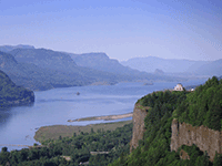
Standing 733 feet above the Columbia River at Crown Point, you are looking at a flood scar of continental proportions. The largest of the Missoula Floods topped this iconic basalt promontory as they were squeezed through the Columbia River Gorge -- meaning the water here was deeper than Crown Point is tall, a churning column of muddy, iceberg-laden floodwater stretching from river to sky. Vista House, the elegant 1918 observatory perched on Crown Point, was built as a rest stop along the Historic Columbia River Highway, but it doubles as an unintentional flood marker: the building sits near the highest water line of the greatest floods. The gorge below was carved over 40 million years as the Columbia River sliced through rising basalt, but the floods dramatically widened and deepened it in a matter of days during each event. From Crown Point's octagonal observation deck, you can see both east into the gorge where the floods accelerated and west toward Portland where they spread across the Willamette Valley. Designated a National Natural Landmark, this is the one spot where the flood story's scale becomes physically visceral -- 733 feet up, and the water was still rising.
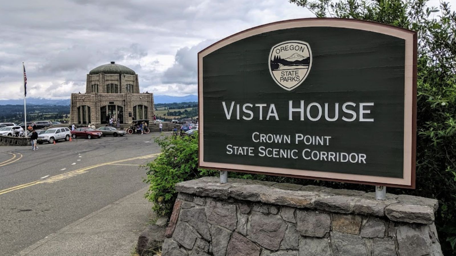
Crown Point State Scenic Corridor is on the Historic Columbia River Highway about 15 miles east of Portland, with Vista House (1918) at the summit. Vista House is open Friday–Monday, 9 a.m.–5 p.m. in summer and 10 a.m.–4 p.m. starting November; the parking area is open 6 a.m.–9 p.m. daily. No entry fee. Vista House closes when winds exceed 50 mph, common in winter and during east-wind events.
Crown Point sits at roughly 730 ft elevation on a basalt promontory shaped by Columbia River Basalt Group flows (~14 Ma). It was designated a National Natural Landmark in 2004 specifically for its expression of Ice Age Floods and Cascade uplift. The summit elevation approximates the upper limit of Missoula flood inundation through the western Columbia River Gorge, floodwaters from the 18.2 ka and subsequent events ran 500–700+ ft deep here, with peak discharges scouring loose material from the gorge walls below. Crown Point is one of the better viewpoints for visualizing the inundated gorge cross-section.
The Balbas et al. 2017 chronology placed the largest western-route flood at 18.2 ± 1.5 ka, before Okanogan-lobe blockage redirected later floods. No site-specific Crown Point geomorphic research has been published since then. No updates found since 2017.
Crown Point is covered under the Ice Age Floods Institute's Columbia River Gorge chapter, which runs seasonal field trips through the gorge. No on-site IAFI-branded panel; NPS National Natural Landmark interpretation is present.
Year-round; best on clear days for east-up-river views. Often combined with Multnomah Falls and the lower Historic Columbia River Highway waterfalls.
Ice Age Floods National Geologic Trail–Historic Columbia River Highway
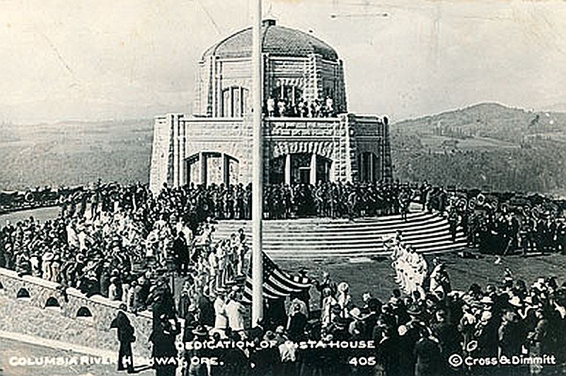
This spectacular viewpoint along theHistoric Columbia River Highway30 was the site of the 1916 dedication of a highway that was, for that time, an innovative European-style road that traced a winding path through the perilous Columbia River Gorge, linking Portland and The Dalles.
Vista House opened in 1918 as a glamorous rest stop and observatory for those traveling the new highway. This “comfort station” was a rest stop like no other, featuring marble floors, stained glass windows, and, of course, a stunning view. In the words ofThe Oregonian, it was “the finishing achievement for the greatest highway in America.”
Architect Edgar M. Lazarus designed the building to be functional, beautiful and commemorative; a memorial to the settlers who had traveled the final stretch of the Oregon Trail along the Columbia River. Stone panels inside are carved with the names of settler families. Listed on the National Register of Historic Places in 1974, the building fulfills Lazarus’s vision as a “temple to the natural beauty of the Gorge.”
The octagonal building houses a museum, gift shop and interpretive display of historic and geologic points of interest in the Gorge. Additional information about the site’s history can be found at the National Park Service website in theirVista House brochure. The landmark is open daily, weather permitting. It closes when winds reach 50mph or more.
The Columbia River Gorge at Crown Point passes from the steeper, more rugged terrain of the western slopes of the Cascade Range to the broad Willamette Valley that stretchs along the western edge of the High Cascades from Oregon into Washington.
To the east the spectacular Crown Point section of the Columbia River Gorge was downcut through thick 16 million year old flood basalts by the much older Columbia River as the Cascade Range rose over the past 5 million years. About 16,000 years ago the ice-age Missoula Floods roare

Flood-extent overlay shows the maximum reach of the Missoula Floods.
The site in its place along the flood path, with the maximum flood extent drawn over the modern map.
View on the interactive map Searchable sites · 360° trails · flood reconstruction