 Washington
Washington
Washington
In the Horse Heaven Hills near Kennewick, Washington, an active paleontological excavation is unearthing the remains of Columbian mammoths that roamed this landscape during and between the Ice Age Floods. The Coyote Canyon Mammoth Dig has...
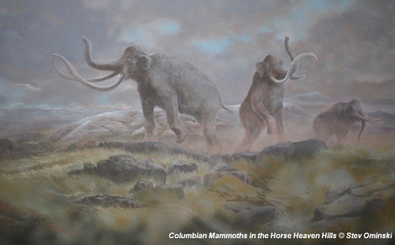
In the Horse Heaven Hills near Kennewick, Washington, an active paleontological excavation is unearthing the remains of Columbian mammoths that roamed this landscape during and between the Ice Age Floods. The Coyote Canyon Mammoth Dig has revealed bones, tusks, and teeth from these massive creatures -- animals that stood 13 feet tall at the shoulder and weighed up to 10 tons -- buried in flood-deposited sediments. The dig site provides a window into the ecosystem that existed alongside the catastrophic floods: between flood events, which were separated by decades, mammoths, giant ground sloths, and saber-toothed cats inhabited a landscape repeatedly reshaped by water. The sediment layers at the site record alternating periods of flooding and habitation, with mammoth remains found between rhythmite layers deposited by successive floods. This is one of the few places on the Ice Age Floods trail where the geological story and the paleontological story are literally stacked on top of each other. The dig is ongoing, and new discoveries continue to shed light on how ice age megafauna coexisted with the most violent floods on Earth.
The Coyote Canyon Mammoth Site is a private active paleontological dig south of Kennewick at 1701 S. Clodfelter Road, operated by the nonprofit MCBONES Research Center. Public access is by guided tour only, scheduled days through 2026 include April 17, 18, 25; May 16, 23; June 20, 26, 28, with additional July–October dates opening for registration June 1. Tickets are $10 per person, tours run roughly two hours, the site is not ADA-accessible, and tours fill quickly.
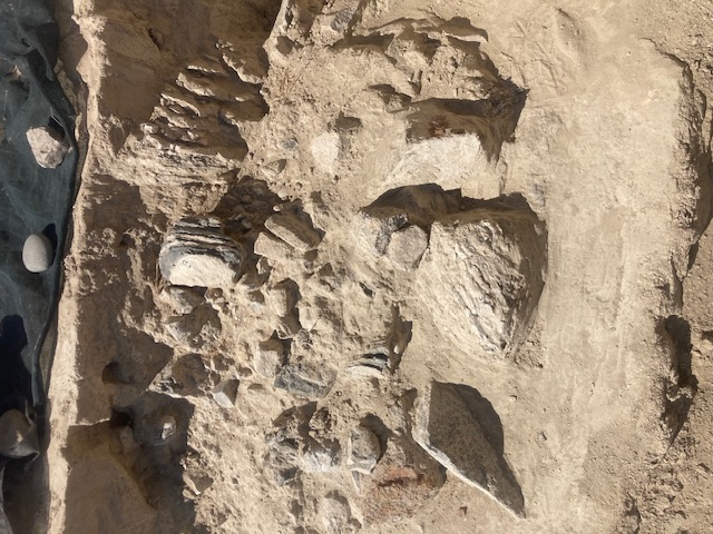
The site preserves the remains of a single Columbian mammoth (Mammuthus columbi) discovered in 1999 during quarry operations. The carcass sits at roughly 1,060 ft elevation in the Horse Heaven Hills, within the inundation envelope of Missoula floodwaters that backed up against Wallula Gap and pooled across the Pasco Basin to form temporary Lake Lewis. The leading interpretation is that the animal was drowned by, or its carcass redeposited on the hillside by, one of multiple Lake Lewis high-stands (potentially up to seven flood events touched this elevation). Over 700 specimens, including 100+ mammoth bones, have been recovered.
Excavation has continued steadily through 2024–2026 with seasonal volunteer crews. No peer-reviewed publication has redated or reinterpreted the find since the original site description; age is consistent with the broader 18.2–14 ka flood window, though specific stratigraphic dating of the bone-bearing horizon has not been published.
The Ice Age Floods Institute lists Coyote Canyon as a featured site, and Lake Lewis chapter members have participated in tours. The site is operated independently by MCBONES; no formal IAFI partnership or branded interpretive panel.
April through October. Worthwhile for visitors interested in the Lake Lewis high-stand evidence and in seeing an active dig with bones in situ. Book well ahead.

Flood-extent overlay shows the maximum reach of the Missoula Floods.
The site in its place along the flood path, with the maximum flood extent drawn over the modern map.
View on the interactive map Searchable sites · 360° trails · flood reconstruction