 Montana
Montana
Montana
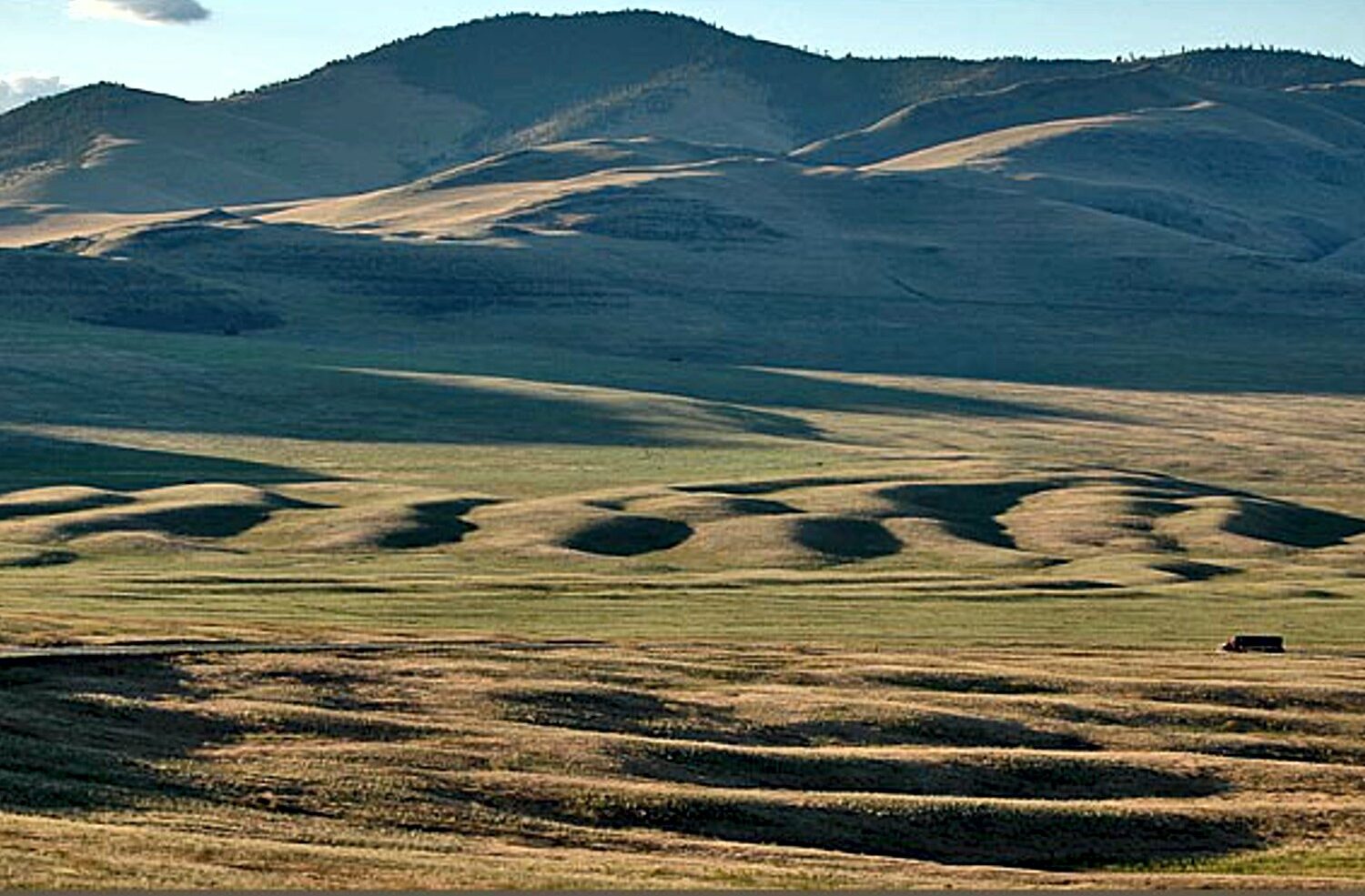
The largest current ripple marks on Earth stretch across Camas Prairie in western Montana, with individual ridges rising 15 to 50 feet high, spanning 100 to 250 feet wide, and running up to half a mile long. These are not sand ripples but...
The largest current ripple marks on Earth stretch across Camas Prairie in western Montana, with individual ridges rising 15 to 50 feet high, spanning 100 to 250 feet wide, and running up to half a mile long. These are not sand ripples but ridges of boulder-sized debris, sculpted by currents so powerful they beggar the imagination. The ripples were created as Glacial Lake Missoula catastrophically drained through this valley during as many as 40 to 100 separate flood events over approximately 4,000 years, beginning around 17,000 years ago. Glacial Lake Missoula itself was a monster: 3,000 square miles of water, 500 cubic miles in volume, and 2,000 feet deep at the ice dam -- larger than Lake Erie and Lake Ontario combined. When the ice dam collapsed, this entire volume emptied catastrophically, and the currents that formed these ripples were traveling at speeds and volumes that defy everyday experience. Located 12 miles north of Perma, Montana, and designated a National Natural Landmark, the ripples are best appreciated from the air but are also visible and walkable from ground level. These ridges of boulders, shaped like ordinary stream ripples but scaled up a thousandfold, are the single most persuasive proof that the floods really happened.
The Camas Prairie giant current ripples are visible from Montana Highway 28 between Plains (junction with MT-200) and Hot Springs / Elmo. The drive crosses the prairie roughly 12 miles north of Perma. The ripples are on a mix of private, public, and land-trust property (Flathead Land Trust holds a 3,867-acre conservation easement on part of the prairie); the highway itself is the public viewing corridor. No fees; year-round access. Ripples are designated a National Natural Landmark (1971) as "Glacial Lake Missoula National Natural Landmark."
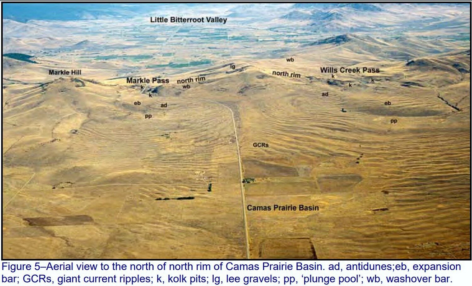
Camas Prairie holds the largest known subaqueous current ripples on Earth: ridges 15–50 feet high, 100–250 feet wide, and 300 feet to a half-mile long, in arc-shaped trains. They formed underwater during catastrophic drawdowns of Glacial Lake Missoula, when discharge through the Eddy Narrows constriction at the prairie's southwest exit reached an estimated peak of 10 cubic miles per hour with water roughly 1,000 feet deep. Approximately 380 cubic miles of water passed through the narrows during a single drawdown. The ripples are aligned transverse to flow and record the bedforms of these immense underwater currents.
No updates found since Pardee's original 1942 description and subsequent confirmation work in the late 20th century. Balbas et al. (2017) anchors regional flood timing. Montana Tech's 2023 luminescence-dating release dated flood gravel exposure ages in Montana for the first time, with implications for outburst frequency.
IAFI maintains a dedicated page (titled "Glacial Lake Missoula National Natural Landmark"). The Glacial Lake Missoula Chapter (Missoula) leads field trips to the prairie. The CSKT Bison Range visitor center (within day-trip range) interprets the same lake history.
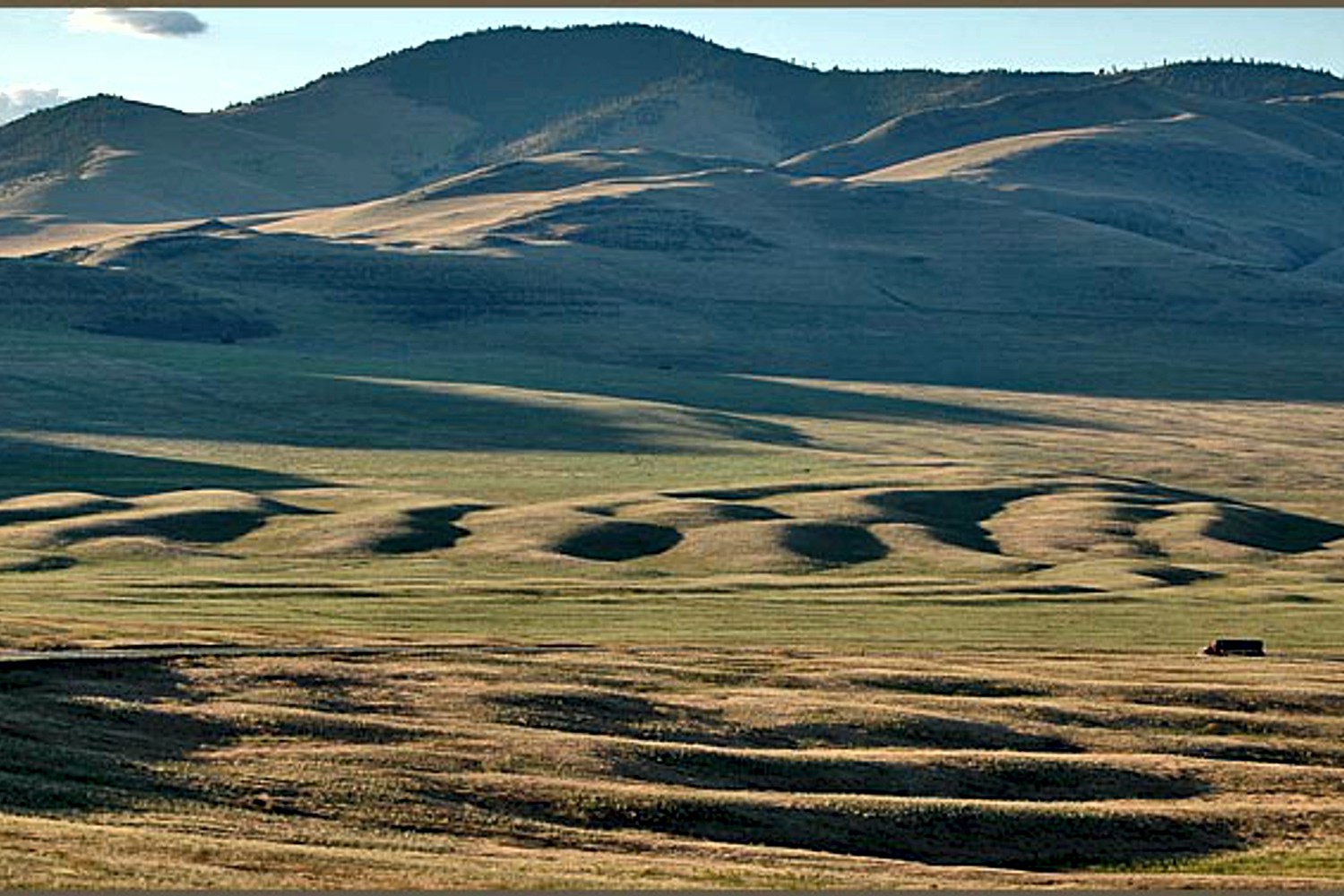
Best in early morning or late afternoon when low sun angles cast shadows that reveal the ripples; in midday flat light the prairie can look unremarkable. Spring (after snowmelt) and fall offer the best contrast. Drive Highway 28 between Hot Springs and Plains and pull off at signed overlooks. Aerial photographs reveal the ripple pattern far better than ground views.
The Camas Prairie Ripples, located 12 miles north of Perma, Montana, appear as prominent ridges 15 to 50 feet high, 100 to 250 feet wide, and from 300 feet to a half-mile long – the largest ripples on earth. While the form, structure and arrangement of these features are similar to that of ordinary current ripple marks, they are termed giant flood ripples, due to their large size. Most ripples that are formed by rivers today are only inches high and are mostly made up of sand-sized particles. Many of the Camas Prairie ripples are composed of boulder-sized geologic debris, and since the size of ripples is related to the strength of a river’s currents, these ripples were created by currents so powerful they are difficult to comprehend. The best examples of giant flood ripples are found in Camas Prairie.
The Camas Prairie Ripples were formed by strong currents associated with as many as 40 to 100 emptyings of Glacial Lake Missoula over 4,000 years beginning some 17,000 years ago. Glacial Lake Missoula was formed by a massive lobe of the Pleistocene Cordilleran ice sheet that blocked the mouth of the Clark Fork River at Lake Pend Oreille, Idaho, a result of successive advances of the Cordilleran Ice Sheet during the Ice Age, when mammoths, saber-toothed cats, and giant ground sloths still roamed the landscape. It was the largest of several lakes impounded by the Cordilleran Ice Sheet in the Northern Rocky Mountains during the Quaternary period.
The lake that formed behind the ice dam expanded until it was 3,000 square miles, held 500 cubic miles of water, and was 2,000 feet deep – as big as Lakes Erie and Ontario combined. It occupied the Mission, Jocko and Little Bitterroot valleys, drained by the Flathead River; and the Missoula, Ninemile and Bitterroot valleys, drained by the Clark Fork River. When the ice dam eventually collapsed Glacial Lake Missoula emptied catastrophically to the west on across the Columbia Plateau and down the Columbia River Basin, its waters

Flood-extent overlay shows the maximum reach of the Missoula Floods.
The site in its place along the flood path, with the maximum flood extent drawn over the modern map.
View on the interactive map Searchable sites · 360° trails · flood reconstruction